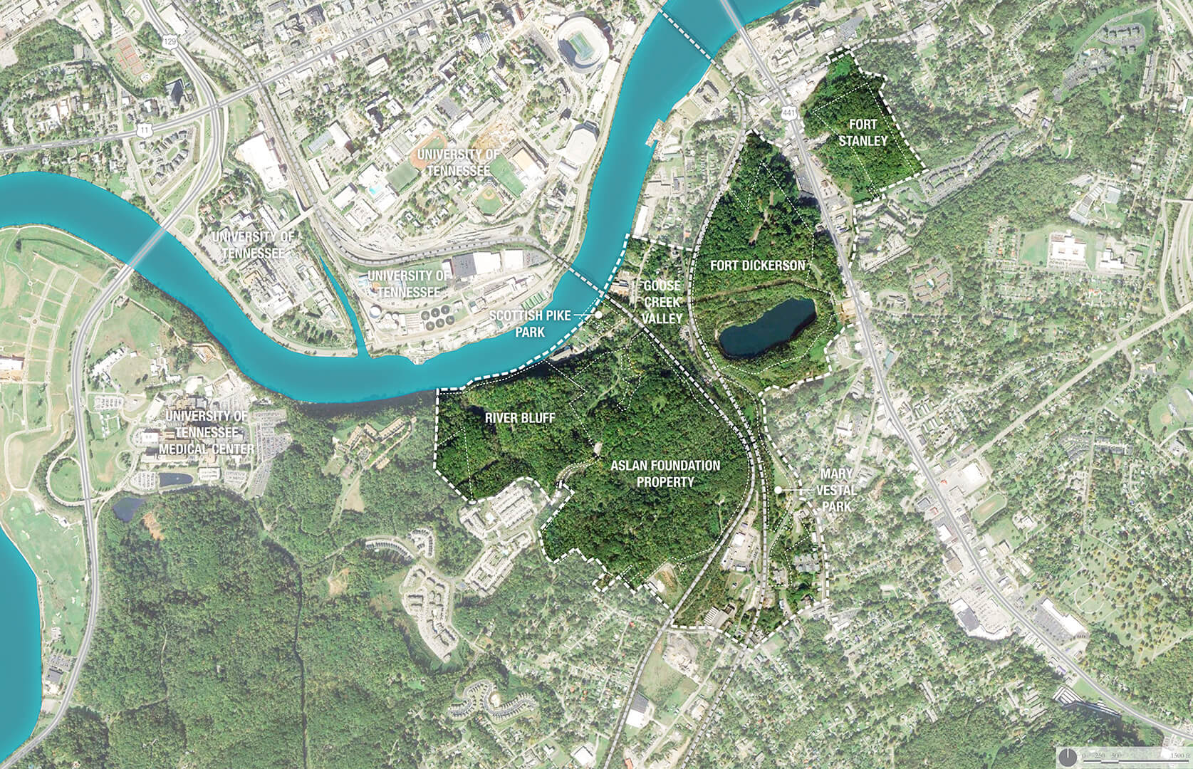
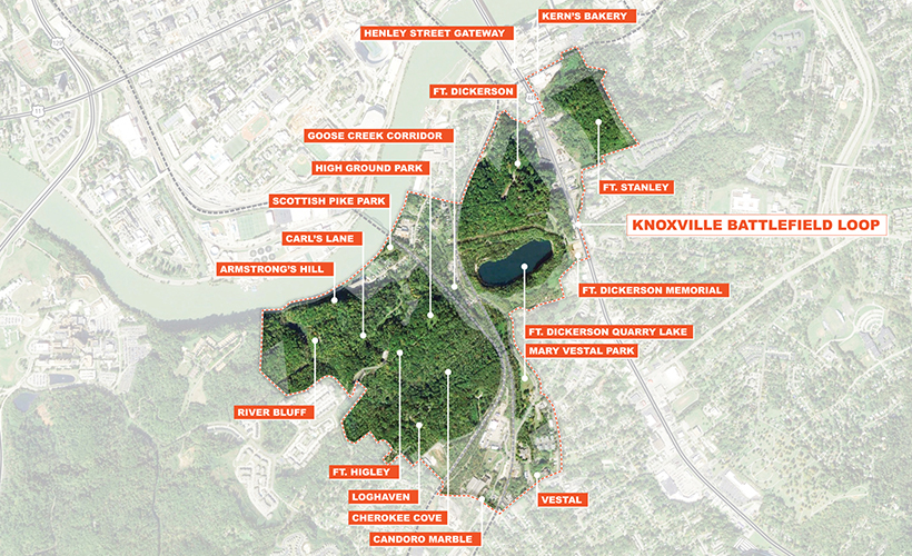
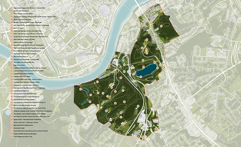
The Knoxville Battlefield Loop comprises 600-acres of post-industrial landscapes and historic landmarks, including three (Union) civil war defense fortifications and a battlefield site.

THE ASLAN FOUNDATION
Knoxville Battlefield Loop
Knoxville, TN
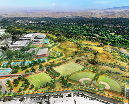
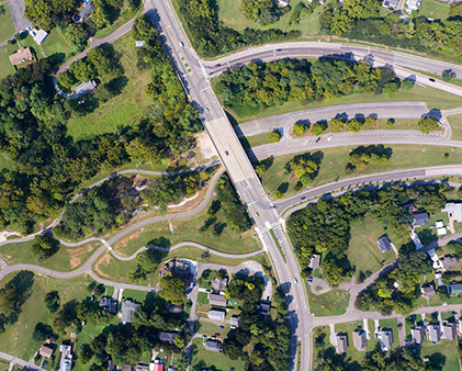
PORT was commissioned to develop a framework plan for 600-acres of forest overlooking the Tennessee River in South Knoxville. The territory includes underutilized assets such as three (Union) civil war defense fortifications; two naturally occurring lakes and a large quarry lake; a 200’ high bluff overlooking the University of Tennessee and Tennessee River below; as well a collection of informal trails that have emerged through the ad-hoc usage of the land. The project endeavors to preserve the land in this area of Knoxville for its environmental, recreational and cultural assets. The plan provides a framework for this activity by increasing accessibility to the territory through the establishment of a legible circulation network that connects the preserved territory back to the city at large. This network is punctuated by a series of collection areas, over-looks, and event spaces including swimming venues, outdoor classrooms, trails and trailheads, bridges, and a community amphitheater.
COLLABORATORS
Architect: Sanders Pace Architecture
AWARDS
2018 ASLA Tennessee Merit Award
SERVICES
Landscape Planning + Design
Project Site
In addition to increasing circulation within the Knoxville Battlefield Loop, it was vital to identify key access points. The plan provides a framework that increases accessibility to the territory through the establishment of a legible circulation network that connects the preserved territory back to the city at large.
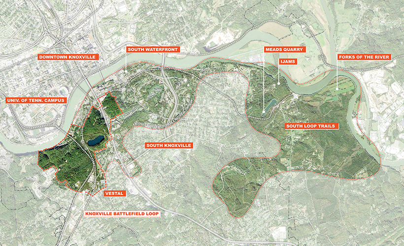
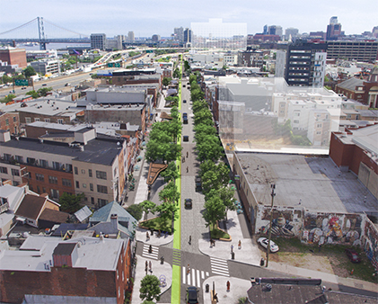
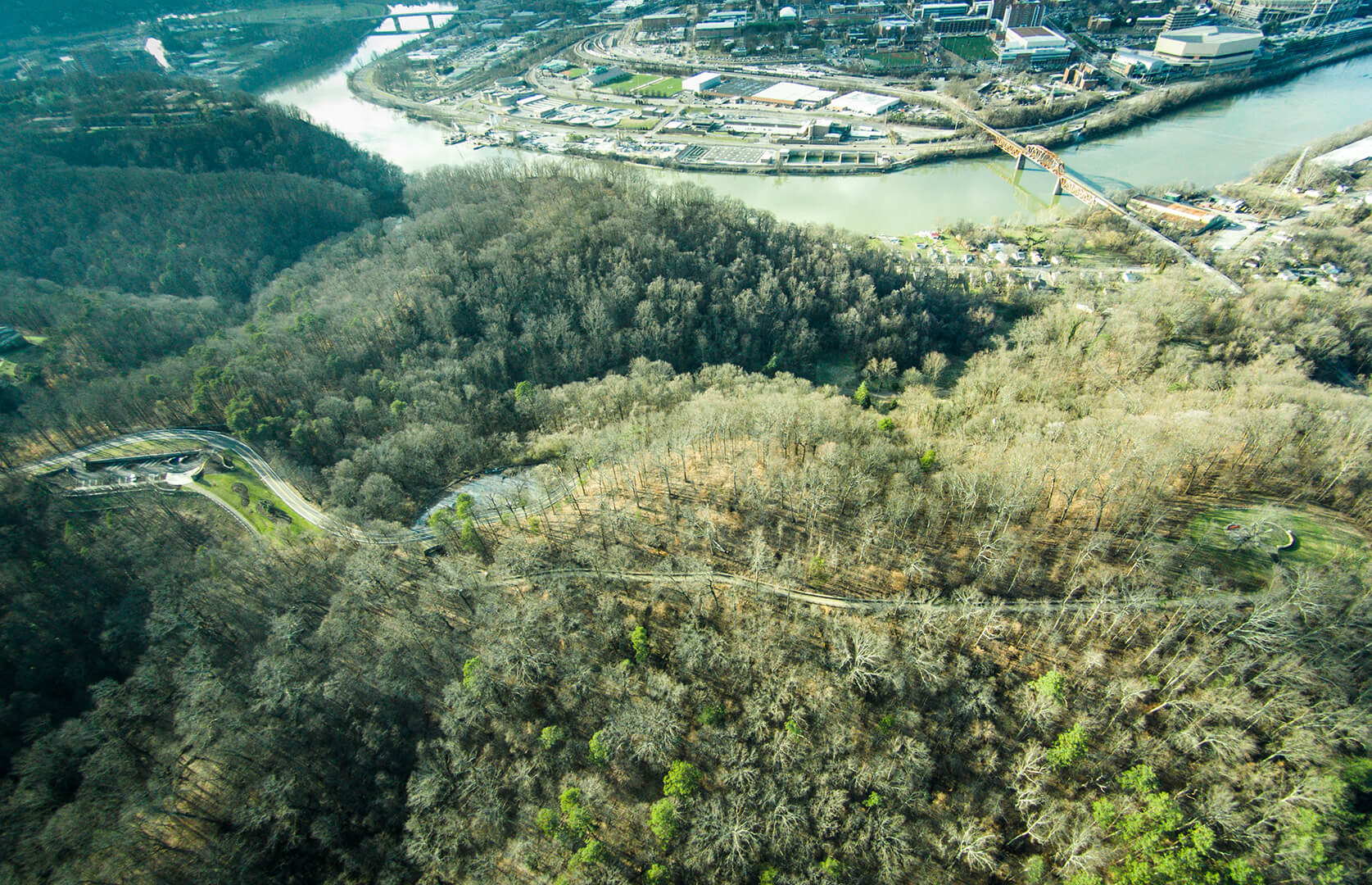
Surrounding Context
The Knoxville Battlefield Loop is a significant natural and cultural amenity and is part of the greater Knoxville Urban Wilderness.
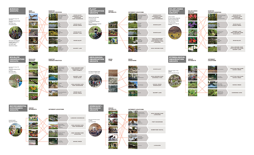
User Group Analysis
The planning team implemented an intense user group mapping exercise and conducted a comprehensive analysis of potential user groups. Ideal access points and routes for over 200 user groups across the 600-acre project area in order to create and establish a hierarchy for the trails, amenities and features related to their interests.
Art by Sentrock; Photo by Dillon Goodson
User Group Analysis
This bottom-up approach produced a circulation and access strategy for the loop and supported the productive overlap of the most diverse possible user base. Each node became representative of the interests of each user group, and its location and proximity to primary access points.
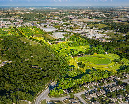
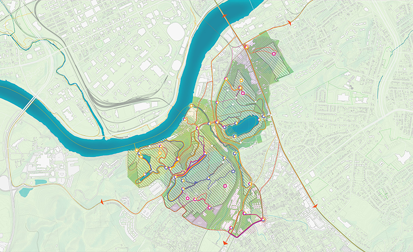
Framework Plan
The user group circulation and access strategy was elaborated to produce approximately 45 sub-area projects, ranging from new parking and access points, to the enhancement of key Battlefield Loop features, like the Armstrong’s Hill Overlook and Fort Dickerson Quarry Lake.
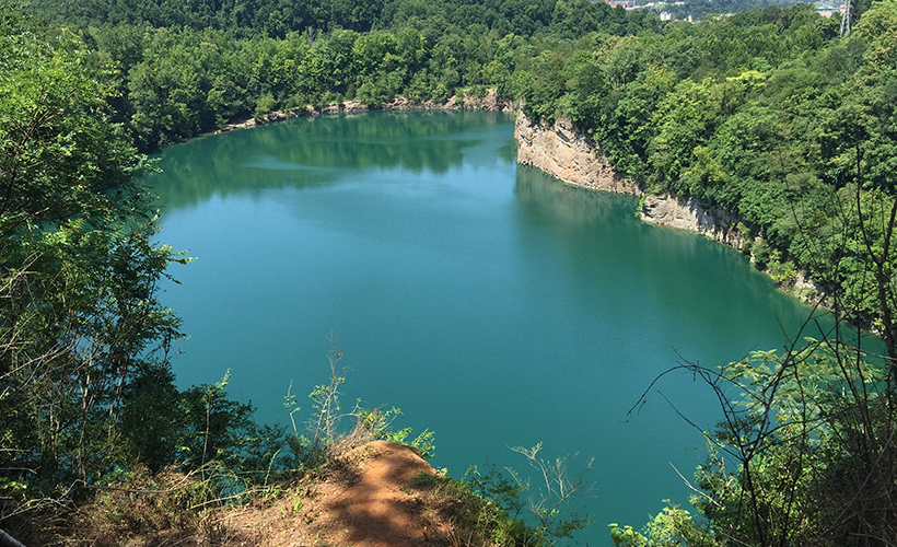
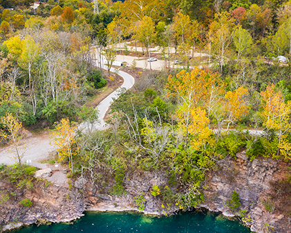
Fort Dickerson Sub Study Area
The Fort Dickerson sub area contains an interesting post-industrial history that has been reclaimed by nature. The most obvious feature of this industrial past is the quarry lake, formally a limestone gravel quarry.

Augusta Quarry Sub Study Area
Each sub area was diagrammatically elaborated on at the scale of the node to understand it at the local context. These studies then informed how the sub area is connected to other adjacent sub areas, and its relationship to primary access points into the system.
The Knoxville Battlefield Loop planning process identified and prioritized 64 individual projects to be implemented over the next 25 years.